Freya Castle
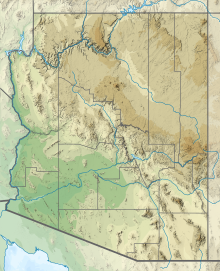
Landform in the Grand Canyon, ArizonaFreya Castle is a 7,288-foot-elevation (2,221-meter) summit located in the Grand Canyon, in Coconino County of northern Arizona, US. It is situated one mile southeast of the Cape Royal overlook on the canyon's North Rim, 1.5 mile north of Vishnu Temple, and 1.7 mile northeast of Wotans Throne. Topographic relief is significant as it rises 3,400 feet above the Unkar Valley in one mile.
Read article
Top Questions
AI generatedMore questions
Nearby Places

Cape Final Trail
Grand Canyon hiking trail

Cape Royal Trail
Grand Canyon hiking trail

Vishnu Temple (Grand Canyon)
Landform in the Grand Canyon, Arizona

Wotans Throne
Landform in the Grand Canyon, Arizona

Angels Gate
Landform in the Grand Canyon, Arizona

Apollo Temple
Landform in the Grand Canyon, Arizona

Jupiter Temple
Landform in the Grand Canyon, Arizona

Thor Temple
Landform in the Grand Canyon, Arizona


